Bibat Fm
Period:
Jurassic, Cretaceous
Age Interval:
Late Tithonian to ?Barremian
Province:
W.India Kutch Basin
Type Locality and Naming
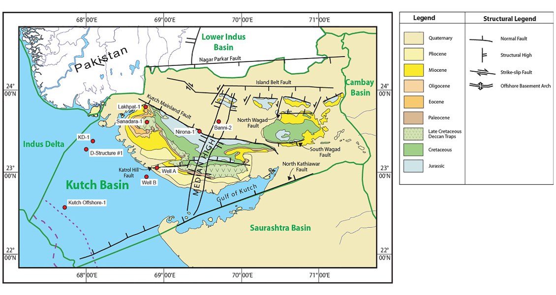
Subsurface (Local?): Interval 616 to 725 m in well Banni-2 (Zutshi et al., 1993)
[Fig. Geological and structural map of Kutch, also showing the onshore and offshore wells drilled for oil exploration. (Map by Rasoul Sorkhabi in GeoExpro Dec2014, based on various sources including S.K. Biswas, Current Science, 25May2005)]
Lithology and Thickness
Claystone. Consists of variegated claystone with minor sandstone at the top, Lignite and carbonaceous matter also present in minor quantity. 109 m thick in Banni-2, 127 m in Nirona-1
Lithology Pattern:
Claystone
Relationships and Distribution
Lower contact
Unconformable (?) with Jhuran Fm
Upper contact
Unconformable with undifferentiated Khari Nadi Fm and Chhasra Fm (Neogene)
Regional extent
GeoJSON
{"type":"Feature","geometry":{"type":"MultiPolygon","coordinates":[[[[67.55,22.63],[67.97,23.37],[68.51,23.97],[68.92,23.99],[68.94,24.29],[69.69,24.28],[69.87,24.17],[70.13,24.18],[70.2,24.28],[70.61,24.39],[70.59,24.24],[70.89,24.24],[70.99,24.33],[71.13,24.42],[71.02,24.45],[71,24.55],[71.1,24.65],[71.31,24.62],[71.39,24.37],[71.3,24.27],[71.33,23.97],[71.27,23.81],[71.63,23.35],[71.55,23.24],[71.34,23.27],[69.59,22.72],[68.13,22.15],[67.55,22.63]]]]}}
Fossils
D. kummi-H. pacilis R.Z. and Epistomina ventricosa R.Z. (Pandey and Dave, 1993).
Age
Upper Tithonian to Neocomian (= within Berriasian-Barremian interval)
Age Span:
Beginning stage:
Tithonian
Fraction up in beginning stage:
0.5
Beginning date (Ma):
146.17
Ending stage:
Valanginian
Fraction up in the ending stage:
1.0
Ending date (Ma):
132.60
Depositional setting
Depositional pattern:
Additional Information
Compiler:
Modified from Jitendriya Mishra (2009) Kutch-Saurasthra Basin, Chap. 17 in ONGC Bull 44
